
JP VJETRENICA
The Vjetrenica Cave is a tourist attraction located in the municipality of Ravno, it is one of the largest cave systems in Bosnia and Herzegovina. Explored 7,323.90m, 700m is used for touristic purposes. Exceptional biodiversity. Rich in cave decorations. It is on the preliminary list of UNESCO World Heritage Natural Monuments. Unique for the strong wind on summer days.
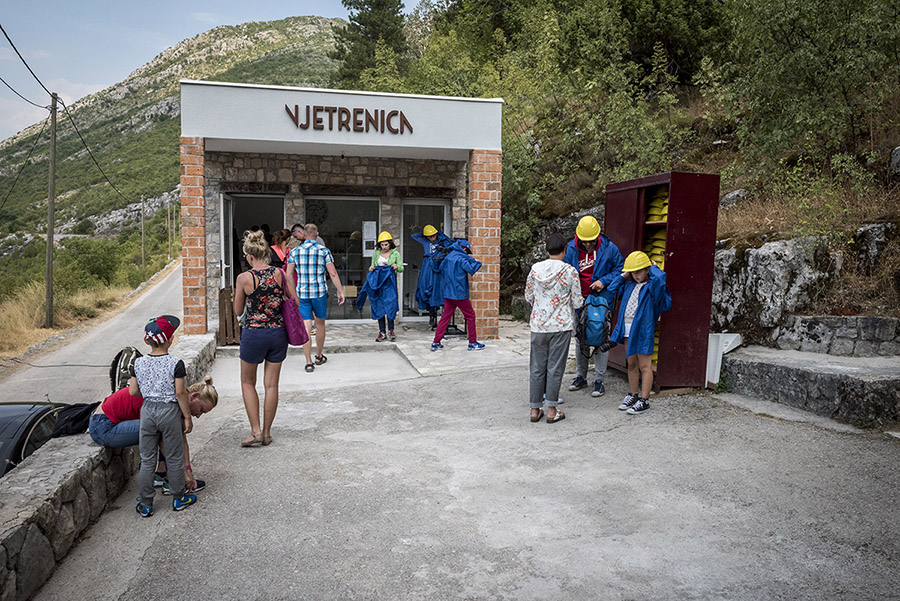
Located next to the old "ĆIRO" narrow-gauge railway, now a bicycle path. Nearby biospeleological museum and INFO center Vjetrenica.
Working hours
- 01.06-31.08 od 09 do 19
- 01.04-31.05 od 09 do 16
- 01.09-30.09 od 09 do 18
- 01.10-31.03 od 09 do 14
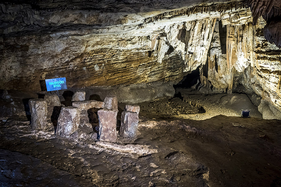
Vjetrenica is a hydrologically active flowing speleological object with as many as 4 water streams, and dozens of smaller periodic streams with underground lakes. It is located in the southern Dinaric karst area, with the entrance at the very edge of Popovo polje, 300m east of the center of the village of Zavale at 260m above sea level, 12km aerial distance to the Adriatic Sea.
- Length of the canal: 7,013.90 meters.
- The basic direction of the cave channels: south-southeast (toward the sea).
- Wind strength in summer days: 15 meters per second.
- Average temperature: around 11°C.
- Arranged for tourist needs: before 1940.
- Extensively landscaped and electrified: in 1964, 1050m long with 1800m landscaped track.
- A protected natural monument since 1952, in the category of special geological reserves since 1965
- In 2004, it was nominated for UNESCO's preliminary list of world heritage.
History of the Cave
This object was mentioned for the first time in the middle of the 1st century AD in the work "History of nature" (Historia naturalis) published in 77 by Pliny the Elder, and later by other authors, for example Getaldić.
Systematic scientific research began only at the end of the 19th century, Groller (1889), Vavrović (1893), Katzer (1903), and others.
The most systematic scientific research of the cave was carried out by the Czech scientist (biologist, geographer, speleologist, paleontologist) Karel Absolon in the period from 1912 to 1914, when he discovered almost all the cave channels known today.
Topographic measurements and the first draft of the cave were made by Serbian geographer Mihajlo Rdaovanović (1929), while the hydrological cave was investigated by geomorphologist Sime Milojević (1938).
The complete plan with the use of a theodolite was made in 1958 by the Energoinvest company and the Speleological Association of Bosnia-Herzegovina Karst.
The latest research carried out since 2000 by the speleologists of SD Velebit from Zagreb resulted in the discovery of new channels and the most accurate topographical plan.
Since 2005, monitoring has been carried out, which includes continuous measurements of air and water temperature and pressure, relative air humidity, air flow speed and direction, and water level.
Underground habitats
The underground habitats of Vjetrenica consist of cave channels, cracks, underground waters and other underground living spaces. As living conditions, they are relatively stable, which means that the temperatures are constant (mostly the average annual temperatures of the area), as well as the air humidity, which is usually maximum. Underground habitats are quite dark and due to the lack of plants there is a constant relative scarcity of food.
Web: https://www.vjetrenica.ba/hr/
VIDEO: Via Dinarica Blue Trail
The facility has a license Bike Friendly Standard (link)